Reading Time: 4 minutes

Miros RangeFinder provides vital insights monitoring the structure of an end-supported Pontoon Bridge

Accurate real-time measurements provide highly valuable data for obtaining both detailed and broad insights into the dynamic behaviour of such a unique bridge structure. Especially for floating structures, weather, waves and other external factors play a crucial role over time.

To download this case study, click here.

Background

The Bergsøysund Bridge is a 931 m long, floating bridge on the northwestern coast of Norway and the second-longest end-supported floating bridge in the world. The steel superstructure rests on 7 separate light-weight concrete pontoons.

The bridge has no mooring, making it particularly interesting to study the environmental excitation sources acting on it and its dynamic response. NTNU extensively instrumented the bridge with different gauges. Since March 2015, Miros RangeFinder sensors have been monitoring single-point wave elevation at six locations along the bridge.

NTNU’s goal is to assess the simulated sea state with the captured parameters. The experience drawn from this is highly valuable when comparing response predictions with the actual measured data providing important insights for future bridge construction.

The Challenge

To verify the simulated behavior of a floating bridge the wave excitation is commonly assumed directly dependent on the sea surface elevation, the main concern for the vibration-based bridge design. Hence, accurate monitoring of the sea state is necessary to assess the quality of response predictions by comparison with measurements.

Available simulations are mainly verified on structures of limited physical reach, and studies verifying simulated floating bridge behavior are very scarce. Waves will in most cases represent the main excitation source for low pontoon bridges, although traffic and wind excitation also play significant roles for certain structures.

Contact us for more details.

The Solution

While Miros RangeFinder sensors were successfully assessing the homogeneity of the sea state along the bridge, NTNU realized that the sensors could also be applied to characterize the directionality of the sea state.

As several tests and the measured data showed that the original sensor layout was not ideal to identify directional sea states, some of the wave radars were moved. The new layout enabled the successful identification of relevant simulated sea states. For NTNU, this result was fundamental to enable benchmarking of the inverse method applied there.

“We are very happy with the job the Miros RangeFinder sensors have done” explains Knut Andreas Kvåle, NTNU.

The comprehensive measurement system set up on the Bergsøysund Bridge now provides highly valuable data and broad insights into the dynamic behavior of a unique bridge structure. The data are used to assess how the environmental parameters influence each other and the response of the bridge. Which is highly beneficial for its performance due to reduced strains and displacements.

Images: NTNU/K.A. Kvåle

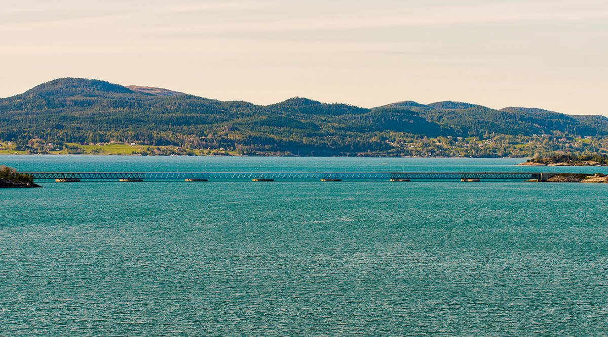
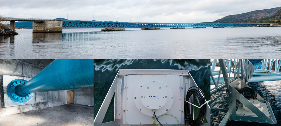
Panorama of the 931 m long, arch-shaped Bergsøysund Bridge. The bottom left image shows the end connection rod on one of the sides (similar on both ends). The middle and right image show how Miros RangeFinder sensors dry-mounted along the bridge.

Conclusion

For future verification of calculation models for floating bridge behavior, field measurements and a system identification survey should always be performed. The measurements provide highly valuable data for obtaining both detailed and broad insights into the dynamic behaviour of such a unique bridge structure. The data allows assessing how the environmental parameters influence each other and the response of the bridge.

Especially for floating structures, weather, waves and other external factors play a crucial role in how the bridge will behave over time. Hence, from a safety perspective, a comprehensive understanding of the effect of environmental parameters on the bridge response is essential and should be guiding for future structure planning.

Miros RangeFinder

Miros RangeFinder provides reliable, real-time measurements of airgap, tide, water level, and draught with millimetre accuracy. It is unaffected by fog, rain, and water spray and uses a frequency-modulated continuous wave approach to discard erroneous observations and provide immediate, real-time, data to resolve surface waves. It can provide up to 50 measurements per second but can also be configured to sample at lower rate.

The RangeFinder is an IoT-enabled sensor giving secure access to real-time data about the ocean state. The sensor provides motion compensation for use on floating assets, where it is the only DNV-certified product on the market for alpha-factor-related wave monitoring.

To download this case study, click here

Read more about our solution for the Ports & Coastal market.

Contact us for more details.

References:

  • Petersen, Øiseth, Lourens – 2019 – Full-scale identification of the wave forces exerted on a floating bridge using inverse methods
  • Kvåle, Øiseth – 2017 – Characterization of the wave field around an existing end-supported pontoon bridge from simulated data
  • Kvåle, Øiseth – 2017 – Structural monitoring of an end-supported pontoon bridge

Contact Us

We’re happy to help you with any questions about our products and services.